Last updated on January 17, 2021

In this article, I am going to discuss plate tectonics and how to use it in your worldbuilding to create an interesting fictional map. If you are creating a fantasy setting for your story or game, you want to make the world interesting, but also have it make sense geologically.
I have seen so many fantasy novels with a map at the front that make absolutely no sense from a geological view. How did that mountain range get there? Why is there a lone volcano in the middle of a continent? Tolkien is not immune from this critique, but I’ll give him some slack because he created his world before the theory of plate tectonics was developed.
Why a Continent Sized Fictional Map?
We previously discussed how maps are less distorted when looking at smaller areas of a globe, so we will work with a continent or two at a time. We are going to build continents from scratch by exploring plate tectonics.
Based on my last worldbuilding maps article, we understand how curved surfaces are distorted when laid out on a flat map. Armed with that knowledge, we can start putting ideas on the map. I don’t recommend doing what I did and plaster paper on a globe and move the continents around. We’re going to switch back to working with a flat map.
Plate Tectonics
The basic concept of plate tectonics is that plates cover the planet, moving across the surface of the globe. The plates may be continents, ocean floor, or a combination of the two.
The basic concept is that spreading zones push the plates across the globe and where they meet on the other side, there is a subduction zone. There are also transform sliding boundaries, but we will skip that for now.

Cratons
Each continent has a core, called a craton, that moves across the surface. The craton is moved across by the force of the spreading zone. Here’s an example. Let’s call it Circlea, because, well.

The leading edge of the craton is pushed up and distorted as it moves across the surface. The interior and following edge stay relatively stable, geologically. We will see some exceptions to this later. We will also see how landforms are created in these areas in later articles. For now, let’s focus on the leading edge.
Leading Edge of Continents is Geologically Interesting
As we saw in the first image showing the cross section of the plates, subduction zones create volcanoes. Anyone in the Pacific Northwest, Central America, or the Andes is familiar with these.

These volcanoes raise high mountains and extend the land of our fictional map of Circlea, often in arcs extending away from the craton. This is often the most basic of continents. South America or Antarctica are examples of this.

Image: On the World Map. http://ontheworldmap.com/antarctica/large-detailed-map-of-antarctica.html 
Image by On the World Map
Island Arcs
Sometimes, the subduction zone might jump, creating a chain of islands off the coast of the continent. These islands become the volcanic mountains of the subduction zone while the former mountain range of the continent erodes into hills or low mountains. This might also be a good time to talk about back arc spreading, but let’s not get too complicated. You can research that for homework!

Now we’re starting to get some interesting landforms to set a story or game in. You could focus on the lands along the sea behind the island arc. Set the villain in a volcanic region and the peaceful villagers in the hills on the continent. With some horse-riding marauding bandits from the interior or pirates on the coast, you’ve got a good setting already.
Examples of the island arc would be Japan, Solomon Islands, Phillippines, Indonesia, pretty much the whole western Pacific. But why stop here? Let’s see where we can take this.

Compiled and edited by Øyvind Engen, Sverre Planke, Reidun Myklebust, Frode Sandnes, and Erling Frantzen. https://vbpr.no/products/geophysical-atlases/geophysical-atlas-of-the-sea-of-okhotsk/
Gathering Terranes
Over time, as more seafloor is subducted under Circlea, the leading edge scrapes up bits from the bottom of the ocean. These may be the new island arcs, seamounts, other islands, underwater landslides off the continent, or simply the muck that lies on the bottom of the sea. All this gets accreted onto the continent. It’s still pretty circular.

This fictional map is starting to look more like North America. Again, we’ll ignore back arc spreading and transform sliding boundaries. It might be more interesting geologically, but for a story setting, less interesting than the island arcs.

Colliding Continents
Want to see something really interesting? What happens when two continents run into one another? When the continent uses up all the seafloor, it will eventually run into another continent. Circlea, meet Ringel. That’s when things get really mixed up. It creates interesting geology as well as an interesting story setting.
Similar to what we saw with island arcs and gathering terranes above, we start seeing islands popping up between the continents. These might be volcanic seamounts shoved up from the bottom of the ocean or simply bits of ocean floor that have no place else to go. As with one continent, the mechanisms are the same, but the complexity rises. Both continents are scraping the oceans as well as affecting each other. Land has nowhere to go but up.


So Much Story Potential
Like our discussion of story possibilities previously, this has a lot of potential as well, but the complexity increases by a factor of two. Now there are multiple islands in the inland sea. Pirates could be on any of them. There are two possible directions the marauding horsemen could be coming from. Where is the villain? In the volcanic mountains? On an island in the sea? Leading the horsemen? The peaceful villages are literally squeezed between two continents.
What real-world analogy of this can we find? The Mediterranean Sea between Eurasia and Africa. All these story possibilities have analogies to European and Middle Eastern History.

Pancirclea
Eventually, the two continents will fuse into one. The sea is gone in our new fictional map. In its place, the mountains and islands have created a high mountain range separating the two continents. Now we have Pancirclea.

This has happened with all the continents in Earth’s geological history, creating the mega-continent of Pangaea.

Hidden Mountain Kingdoms á la Shangri-La
While you might have lost the potential for great stories about pirates and sailing, you now have the potential for stories of hidden mountain kingdoms sealed off from the rest of the world by snow and glaciers. Perhaps those kingdoms have dug warrens of tunnels and caves through the mountains that are now overrun by goblins á la the Mines of Moria from Tolkien.
For a modern world example, the Himalayas are exactly this kind of high mountain range. The continents of Asia and subcontinent of India collided to raise the Himalayas to be the highest region on Earth.

Breaking Up is Hard to Do
You might think we’ve covered all there is to cover in creating interesting settings based on plate tectonics, but we haven’t. What happens when Pancirclea starts growing apart? It’s time for the big split.
Even Pangaea broke up into multiple continents, resulting in the world we see today. The reasons for the breakup aren’t clear, but scientists believe that it is caused because the continents are pulled apart by its own weight. Others have posited that they are pushed apart when a continent moves over a hot spot which forces magma up and out.
In any case, we can mimic a continental breakup. I simply drew a wavy line through the middle of my continent. As the continent breaks up, it doesn’t do so evenly, leaving failed rifts. These often later become filled by erosion, though in some cases, might also create smaller, mini continents that break off the larger continent.

The rift zone might not create a full sea, though over time it might. It might simply create a series of lake-filled valleys like the East Africa Rift Zone. This extends to the Red Sea, where a new ocean might be in the process of growing.

New Continents: The Cycle Starts Again
Along the margins of the new inland sea you might find shield volcanoes. These are the flat, low volcanoes like Mauna Loa in Hawaii. they are very different from the explosive volcanoes like Mt. St. Helens in the Pacific Northwest.
As the continents move apart, the inland sea grows. I like inland seas. They offer up so many opportunities for writing about sailing and pirates. Who doesn’t like a good pirate story?
The volcanoes along the edges of the rift die down as the spreading zone stays at the center of the new ocean. The high mountains have eroded into low mountain ranges and hills. Pieces of the old continents are pulled apart, some subsiding and falling into the new ocean. Others break off and create new mini-continents.
The leading edges of the new continents now go through the same process that we started with at the beginning of the article. The new leading edge is pushed up and distorted, while the old leading edge is now the trailing edge, relatively stable geologically.
This new fictional map is a far cry from the simple circle we started with.

This is exactly how the Atlantic was formed between Europe and Africa on one side and the Americas on the other.
What Kind of Fictional Map Have We Ended Up With?
Eventually, these two continents will be too far apart to have much influence on each other in a story unless your world has ocean-going technology or flight. Once you get to that point, you are getting out of the realm of low fantasy. Perhaps your world has magic advanced enough for those technologies, then you are into high fantasy. It might also allow a good science fiction or steampunk story world.
By now, we have created a fictional map of a wide variety of continents, from simple Circlea to its growth and meeting of Ringel and the beautiful inland sea they created together. Then they merged into Pancirclea and later broke apart.
If you don’t want to go through the whole process of creating continents from scratch, you don’t have to. You can simply draw one out, but you should understand the mechanisms of continental development if you want a setting that makes sense geologically.
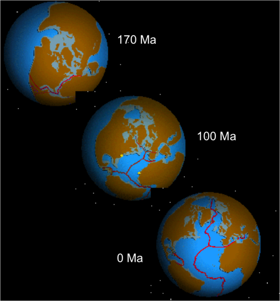
Another option is to let someone else do it for you. I found a fun tool that models plate tectonics at Tectonics.js. It creates continents, runs them through time and motion. It works on a globe, but also maps them on a flat surface. It’s pretty slick. A lot of math went into the model, I’m sure.
What’s Next?
We did not discuss what these different continent types might look like at different latitudes or how they get mapped. We also didn’t discuss the effects of erosion, except in passing. That will be the topic of my next article about climate and its effect on the world. Also coming up, what are we going to do about that evenly curved trailing edge of the continent? How boring is that?

Wohh exactly what I was searching for, regards for posting. Jacquette Lorin Kelby
Thanks! I have a few more with more coming. I’ll be posting one on landforms soon.